
Discourses From the East
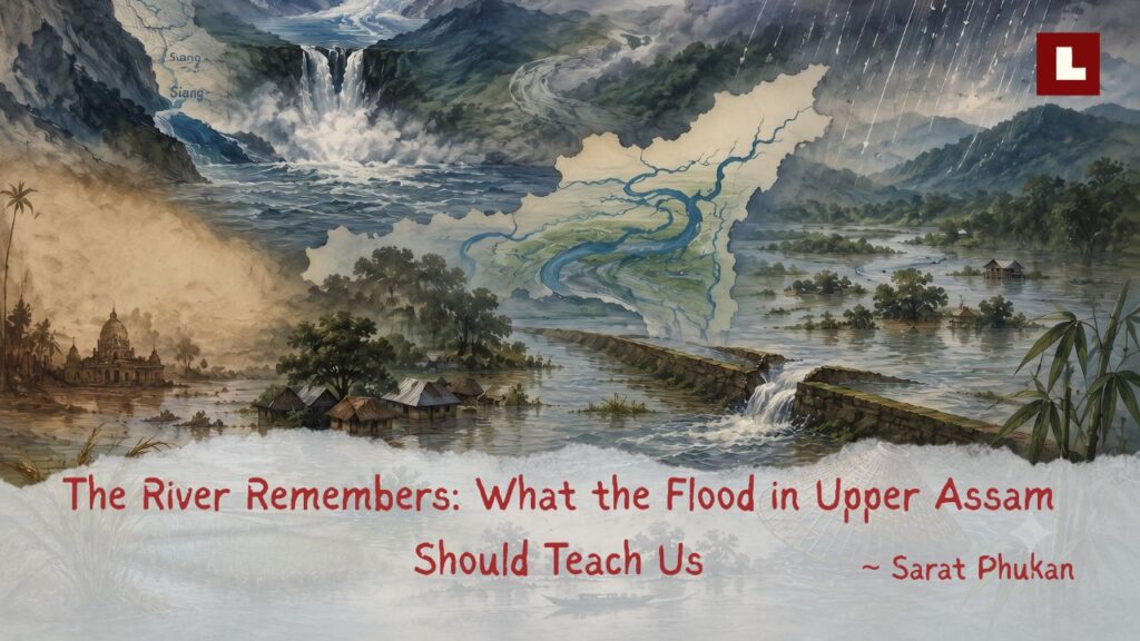

I carry my own memories of great floods. In my childhood, our home was inundated several times by the Jhanji. But one memory still intrigues me. In 1988, I was a student of Sivasagar College, living in a hostel that stood in the middle of a paddy field. One night, water from the Dikhow inundated the hostel. We remained there for two more days, catching fish in the flooded compound, until our provisions were exhausted and we had no choice but to return home. Along the National Highway from Gaurisagar to Jamuguri, thousands of people were sheltering beside the road. The paddy fields on both sides had turned into a sea from which trees and houses protruded. People were angry, for most had lost their granaries and many their livestock. Seeing so many people on the road was new to me, and it has never faded. Whenever I see a flood, read about one, or merely imagine one, that picture still comes back.
In the third week of July this year, Upper Assam entered one of its most severe flood episodes in recent memory. At Nangalamoraghat, the Disang rose to about 96.52 metres, narrowly exceeding the previous highest flood level of 96.49 metres recorded in September 1998, while both the Disang and the Dikhow entered what hydrologists classify as an “extreme flood” condition. By 24 July, more than 7.21 lakh people across eleven districts had been affected, and nearly 900 villages were under water, with Sivasagar suffering the most. Eight stretches of embankment were reported damaged in the Jorhat region alone. At Chikirichuk on the Jhanji, a single breach swept away more than fifty homes. Yet this was not one flood but two unfolding together. While the major rivers overtopped their banks and embankments failed, torrents descending from the Patkai foothills inundated places far from any large channel. At Geleki, streams such as the Denchi and Daikhana submerged extensive areas, while Bihubar and places as distant as parts of Nazira town were flooded by water cascading down from the hills. In some places the water rose so rapidly that helicopter-assisted evacuation had to be considered. The violence of those days seemed exceptional, but the valley beneath the water carries the memory of floods far greater and far older.
A flood older than memory
The oldest chapter in Assam’s flood history lies far upstream, in southeastern Tibet, where the Tsangpo bends around Namche Barwa and enters one of the deepest river gorges on Earth before flowing towards India as the Siang. In 2004, David Montgomery and colleagues published evidence of something almost beyond imagining. At least twice during the Holocene, the geological epoch spanning roughly the past 11,700 years and encompassing the rise of human civilisation, glaciers descending from the Namche Barwa massif extended across the Tsangpo and impounded enormous lakes immediately upstream of the gorge. The larger lake held an estimated 832 cubic kilometres of water; even the smaller one held about 80 cubic kilometres. Evidence shows that at least one of the glacier dams failed catastrophically. Preliminary calculations suggested that such failures could have released peak discharges of one to five million cubic metres per second.
To grasp that magnitude, the greatest discharge recorded in the Brahmaputra at Pandu, near Guwahati, was 72,779 cubic metres per second on 23 August 1962. The preliminary estimates for the Tsangpo outburst floods, between one and five million cubic metres per second, were therefore about fourteen to nearly seventy times greater. A flood of such magnitude could hardly have passed through the gorge and entered the Siang without leaving its mark downstream. Later studies have identified deposits of at least eight megafloods between about seven thousand and one thousand years ago along the nearly 300-kilometre mountainous course of the Siang. One megaflood around five thousand years ago appears to have left its imprint along almost the entire Siang valley. The younger lake was still in existence between AD 690 and 900, when settled societies already occupied the Brahmaputra valley, and its catastrophic failure would have sent a flood of almost unimaginable magnitude towards the Siang and Assam. Whether identifiable traces of that particular flood still survive in the Brahmaputra valley remains an unanswered question.
The Kālikā Purāṇa, probably composed in or near Kāmarūpa in the tenth or early eleventh century, tells how Brahma caused the Brahmaputra to descend under the strokes of Parashurama’s axe. The river spread in a deluge across Kāmarūpa and swept away its sacred tirthas. Their sanctity then passed into the Brahmaputra itself, and the river was thereafter revered in their place. Banikanta Kakati suggested that this story may preserve the memory of one of the great inundations that periodically visited Assam. Such long memories of environmental change are known from other parts of the world. Nunn and Reid found that Aboriginal stories from many parts of the Australian coast may preserve observations of postglacial inundation more than seven thousand years old. This does not prove that the Kālikā Purāṇa records a particular flood. Still, it shows that memories of exceptional changes in water and landscape can sometimes survive for millennia through oral tradition and myth. The later association of the legend with Parashuram Kunda is geographically difficult, because the kunda lies on the Lohit, not on the Siang. Yet people living hundreds of kilometres downstream in a densely forested valley may not have known through which distant eastern river an extraordinary flood had descended. Even in 1837, John M’Cosh wrote in Topography of Assam that it was still uncertain whether the Brahmaputra received the waters of the Tibetan “Sampu”. However, he considered it probable that the Sampu was the same river as the Dihong. If that connection remained uncertain even to a nineteenth-century observer, people living centuries earlier could hardly have known exactly which river had carried the flood down from the eastern mountains. What survived in myth may instead have been the overwhelming memory of immense waters suddenly set free. Could the story contain a distant echo of the first-millennium Tsangpo outburst? We cannot prove it, but the possibility is compelling enough to read geology, geomorphology, and the shastra together.
Floods in the age of kings
Recorded history tells the same story in a quieter but no less compelling register. Floods forced Sukapha to abandon Mungklang Chekhru in 1240 and Habung in 1244. In 1570, floodwaters destroyed crops and brought the country to the brink of famine; in 1642, another heavy flood swept through the countryside, carrying away livestock. The chronicles also record earthquakes that opened the ground and brought down royal buildings. Mir Jumla’s invasion of 1662 became the most dramatic encounter between imperial ambition and the valley’s waters. Once the monsoon arrived, roads disappeared beneath water, streams became rivers, supplies failed, and hunger and disease spread through the isolated Mughal camps. At the same time, the Ahoms attacked from the surrounding countryside. The invasion that had begun in triumph ended in a costly withdrawal.
Floods did not merely overwhelm settlements; they changed the dynamics of the great rivers themselves. Before the eighteenth century, the Brahmaputra flowed north of Majuli through the old Luit channel, now represented largely by the Kherkatia Suti. At the same time, the Dihing followed much of the present Brahmaputra course to the south. After receiving the Disang and Dikhow, it met the Brahmaputra near the western end of Majuli. Around 1750, an extreme flood diverted part of the Brahmaputra into the Dihing channel nearly 190 kilometres upstream of their former confluence. The southern channel became the principal course of the Brahmaputra, the older northern course declined, and Majuli acquired substantially the island form we recognise today. In Assam, even the relationship between the great rivers could be rewritten by a flood.
What is most striking, however, is not simply that floods happened, but how society was organised around them. The Ahom state raised embankments where capitals and cultivated lands required protection, while wetlands and low floodplains remained open to receive excess water. Gait records, for example, that after Suhungmung established his capital at Bakata on the Dihing, embankments were constructed against inundation. Floodplain communities kept boats, cultivated deep-water bao paddy that rose with the water, and moved cattle and grain collectively to higher ground. Flood was a season to prepare for, not always a surprise. The older wisdom was simple: protect what must be protected, but leave the river room elsewhere. That wisdom, giving the river room instead of simply walling it out, is what we have spent the past seventy years forgetting.
The night the rivers changed: 15 August 1950
On the evening of Independence Day, 1950, an earthquake of magnitude 8.6, still among the largest continental earthquakes ever recorded, struck the mountains near Rima, on the Tibet border northeast of Sadiya. The plant explorer Francis Kingdon-Ward, camped near the epicentral region, left one of the most vivid first-hand accounts of the earthquake, describing the ground heaving like a sea and the roar of mountains disintegrating in the darkness. In Assam, M. C. Poddar of the Geological Survey of India documented the aftermath: ground fissures, sand vents spouting water, and riverbanks slumping into channels. But the earthquake’s cruellest work came afterwards, and it came by water. Landslides on an almost unbelievable scale choked the gorges of the Subansiri, the Dibang and the Dihang. A landslide completely blocked the Subansiri. When the natural barrier failed on the night of 19 August, the resulting flood swept through downstream villages and reportedly killed about five hundred people, several days after the earthquake itself. And the damage did not end with that wave. The convulsed mountains poured their shattered rock and sand into the rivers for years. The enormous sediment load raised the Brahmaputra’s bed along long stretches of Assam, promoted braiding and channel instability, and left its fine sandy banks highly vulnerable to erosion. The consequences were severe across Upper Assam: large parts of Dibrugarh were eroded, while the deluge following the 1950 earthquake swept away Old Sadiya. Tributaries shifted course, their gradients changed, drainage across the upper Brahmaputra valley was disrupted, and channels and wetlands were choked with sediment.
This is the single most important fact for understanding modern Assam’s floods: 1950 changed the valley’s hydraulic constitution. The devastating flood of 1954, which led the Government of India to formulate a national flood-control policy that year, was the new regime announcing itself. Our response was to begin building embankments, and we have hardly paused since. Assam today has about 4,474 kilometres of them, much of the system built in the decades after 1954 for rivers that have continued to rise on their own sediment. Many stretches are now old, repeatedly repaired or in need of strengthening; every monsoon some fail. This July, they failed again.
A century of catastrophe, warnings forgotten
Since then, Assam has experienced major floods in 1954, 1962, 1966, 1972, 1988, 1998, 2004, 2012, 2020 and 2022. The 2004 flood remains among the most catastrophic in recent history, affecting over twelve million people. At Nangalamoraghat, the Disang crossed its previous measured record in 2026. Such records belong to particular gauges, but the lesson is universal. Each great flood is called unprecedented, and then, with astonishing speed, allowed to pass out of public memory.
If we want to see where an embankment-only approach can lead, we need only look west, to the Kosi. On 18 August 2008, the eastern afflux bund at Kusaha in Nepal, twelve kilometres upstream of the Kosi barrage, breached at a discharge far below its design capacity. The river shifted about 120 kilometres eastward and reoccupied one of its former channels. Around 80–85 per cent of its flow entered the new course, spreading as a sheet of water fifteen to twenty kilometres wide and about 150 kilometres long. The bund was more than fifty years old and poorly maintained, while seepage and toe erosion had increased its vulnerability. Within the embankments, continuing sedimentation had raised parts of the riverbed four to five metres above the adjoining floodplain. The embankments had not eliminated the danger. They had allowed it to accumulate until one breach released it across the plains.
The parallel with Assam is direct and uncomfortable. The Brahmaputra and many of its tributaries carry large sediment loads from the steep and geologically fragile mountain ranges surrounding the valley, where intense monsoon rainfall and recurrent earthquakes destabilise slopes, particularly those underlain by young sedimentary rocks. The sediment regime of the Brahmaputra was profoundly disturbed after 1950 and is further affected by erosion and human disturbance within its catchments. When confined between embankments, rivers may deposit part of this sediment within their channels and gradually rise relative to the adjoining land, until the floodplain outside lies below the riverbed inside. Every year of apparent protection can therefore raise the stakes of an eventual breach. Embankment breaches are not exceptional in Assam; they recur almost every monsoon on different rivers. This July, a breach in the Jhanji embankment at Chikirichuk destroyed more than fifty homes, while embankments failed or required emergency protection at several other places. Most such breaches remain local disasters, but Kusaha in 2008 showed what can happen when a great river escapes through one weak point. The Kosi abandoned its confined course, turning an embankment failure into a catastrophic flood.
A new sky over an old, bruised valley
On top of this inherited fragility, climate change is now introducing a new kind of rainfall. The physics is simple. Warmer air can hold about 7 per cent more moisture for every degree of warming, making heavier downpours more likely when conditions are right. The IPCC finds that daily precipitation extremes have increased over most of South Asia in recent decades, while changes in river flooding remain more uncertain and vary between regions. Assam’s own State Action Plan on Climate Change projects an increase of five to thirty-eight per cent in extreme rainfall events, and more than a quarter in flood events, by mid-century. It is no longer only a projection. On 19 July, Mon in Nagaland received about 130 millimetres of rain in a day, and Mokokchung 126 millimetres, with very heavy rain falling on hill catchments that drain, through thousands of small streams, straight into the Disang, Dikhow and Jhanji basins of Assam. These basins do not respect state boundaries. Rain in Nagaland or Arunachal becomes flood in Assam within hours.
By then, after days of rain, the soil, paddy fields and wetlands of the plains were already saturated and could absorb almost nothing more. Almost every additional drop therefore added directly to the inundation, pushing water into higher ground and areas not usually reached by floods. Several years of deficient rainfall may also have weakened preparedness and allowed the memory of major floods to fade among farmers, engineers and administrators. Climate change does not simply mean more water. It means wilder swings between too little and far too much, and a planning culture built on averages is helpless in the face of extremes.
Climate change is awakening another danger in the high mountains. The Siang, Subansiri, Jia Bhareli (Kameng) and Manas descend from landscapes shaped by snow and ice. Many glaciers of the eastern Himalaya receive most of their replenishing snowfall during the summer monsoon, whereas winter storms are more important for glaciers in the northwestern Himalaya. Yet here too the ice is retreating, and some glacial lakes are expanding. The greatest danger lies in the narrow valleys below them, particularly in Upper Dibang Valley, West Kameng and Tawang, and in Bhutan around Lunana and the headwaters of the Pho Chhu, Kuri Chhu and Drangme Chhu. If a barrier of ice or loose moraine gives way, a glacial lake outburst flood (GLOF) can rush down with rock and sediment. Nor must the disaster end in the mountains. Entering a river already swollen by the monsoon, a large flood pulse could reach Assam. Fine sediment may arrive with the first waters, while sand and gravel may continue to move downstream during later monsoons, altering riverbeds for years. The ancient Tsangpo megafloods belonged to another scale, but their warning has not grown old. What begins in the silence of the high mountains may one day arrive at our doors as water.
The flood in our minds
A flood is never only an excess of rain. It is also a record of how people, institutions and governments have treated rivers, hills, wetlands and floodplains over many years. Roads and highways are necessary, but when they cross natural drainage without adequate openings, they hold back water that once moved freely. Wetlands, our bils, notified or not, are not vacant land awaiting development; they are part of the river system, receiving and storing water when channels overflow. Yet we continue to fill them with earth, brick kilns and buildings, converting natural flood storage into future disaster. Across the Patkai hills, rampant opencast coal mining, much of it illegal or poorly regulated, is removing forests, disturbing slopes and leaving vast quantities of loose overburden exposed to monsoon rain. Deforestation accelerates runoff and erosion, while indiscriminate boulder extraction at the hill-valley transition removes the natural armour of streambeds. The exposed sand and finer gravel are then rapidly eroded and carried downstream, where they settle as the gradient decreases, raising channel beds, making rivers shallower and reducing their capacity to carry floodwater. These are not separate environmental offences; together they are changing the drainage character of the hills and the adjoining valley.
The history of dam planning in the Brahmaputra basin shows how a public purpose can gradually narrow. Many projects were first examined as multipurpose schemes, with flood moderation, irrigation and hydropower considered together. Over the years, the first two objectives often receded while electricity generation became the dominant realised purpose. A reservoir can moderate floods only when sufficient space is deliberately left empty to accommodate exceptional inflows. After prolonged rain, when the reservoir is already high, and the rivers below are swollen, opening the gates may send an additional surge into downstream villages and fields. The electricity travels to cities and industries through the grid. Still, when reservoir releases aggravate downstream flooding, there is ordinarily no automatic, project-specific compensation for the communities whose homes, fields, livestock, stored grain and livelihoods are damaged. Some may receive limited assistance under general disaster-relief provisions, but relief is not compensation for the full loss. A dam should therefore be judged not only by the power it produces, but also by the water it can safely hold back and the burden it transfers downstream.
The deeper conflict lies between immediate need and distant consequence. For a farming community in the hinterland, protecting the environment may not be an immediate aspiration. Securing the next harvest, paying for a child’s education, meeting medical expenses, and finding income during the lean season are more urgent, while environmental decline and future disasters appear uncertain and distant. For the affluent and commercially powerful, however, the calculation is different. Here the motive is not survival but profit. A forest becomes uncashed coal, a wetland becomes real estate and a riverbed becomes saleable stone. The returns remain private, while the flood, erosion and loss of livelihood are borne by everyone, most heavily by those with the least protection.
The greater difficulty lies in how institutional memory works. A flood is treated as an interruption, followed by relief, repair and compensation, and then gradually forgotten until the next monsoon. But a river does not disappear when the water recedes. It remains present in the height of a road, the width of a culvert, the strength of an embankment, the survival of a wetland, the cutting of a hill and every permission granted to build on low ground. Every culvert absent, every undersized bridge opening, every elevated road without adequate cross-drainage, and every fishery enclosed by raised bunds within a wetland can act as a small dam in the neighbourhood, holding back water and creating immediate danger when extreme rain arrives. The same breaches return, the same repairs follow, and what should have been remembered in planning is rediscovered through damage. Culverts remain unaudited, embankments are restored without addressing their weakness, wetlands disappear quietly, mining continues without regard to the limits of the hills, and flood maps remain documents rather than boundaries.
There is also a social loss beneath this institutional failure. Floodplain communities once understood that individual families could not face such disasters. They kept boats ready, and almost every homestead had banana plants whose trunks could be tied together into an emergency raft when no boat was available. They shared food and shelter, moved cattle together, and collectively rescued children and older adults. Today those bonds are weakening, families are more isolated, and much of the responsibility has been passed upward to agencies that cannot reach everyone at once. Memories of great floods may fade among people. Still, they must never fade within institutions, whose duty is to preserve what individuals forget through forecasting, warning, functional drainage, honest embankment audits, rescue and shelter. Communities must equally rebuild what no agency can supply, including local cooperation, immediate mutual aid and direct communication with villages upstream and across the state boundary, so that intense rainfall in Mon becomes Sivasagar’s warning hours before it becomes Sivasagar’s flood. Government action and community response must support each other; neither can replace the other.
What the river is asking
From the megafloods that carved the Siang valley, to the legends of Parashurama’s axe, to the buranjis’ drowned harvests, to Mir Jumla’s invasion, when plunder and destruction reached even the royal maidams before the monsoon turned the flooded valley against the invading army, to the night the earthquake-induced landslide barrier on the Subansiri gave way in 1950, to Kusaha and Chikirichuk, the record is continuous. It says one thing. This is a valley built by catastrophic water, and it will flood again, sooner and harder than our averages suggest. The question is not whether we can stop the flood. We cannot. The pretence that we can, embodied in every embankment treated as permanent protection, may itself be the most dangerous assumption in our flood policy. The question is whether the next flood will find a valley whose people and institutions have made room for it, with wetlands protected as flood infrastructure rather than filled, enclosed and converted for private profit, roads properly designed and audited for drainage, embankments rebuilt or strategically set back with full knowledge of the risk, land-use laws that respect flood maps, direct communication between upstream and downstream villages so that heavy rain and rapidly rising water upstream become an early warning for communities farther down the river, and a public that treats flood literacy with the seriousness that coastal Japan gives to earthquake drills.
But societies often forget faster than rivers. Silchar remained underwater for days in 2022 after the breach at Bethukandi, yet the disaster now receives little attention beyond those who directly experienced it. Fewer still remember September 2014, when extreme rainfall over the Meghalaya hills sent flash floods across Boko and Bolbola, submerged stretches of NH-37 above rooftop level and killed nearly ninety people across Assam and Meghalaya. The inquiries that followed fixed blame on individuals, at Bethukandi on those accused of cutting the embankment, while the larger questions gradually disappeared. Which roads acted as dams, which culverts were undersized, and which embankments were already known to be weak? Large infrastructure is closely examined before construction, chiefly for cost and clearance, but rarely audited afterwards in public for how it actually performed during a flood. Such forgetting is not innocent. It quietly prepares the ground for the next disaster.
More than sixty years ago, Bhupen Hazarika stood on these banks and asked the river his great question. Bistirno parore, beside countless suffering people and hearing their hahakar, how do you flow on, Burha Luit, silent and unmoved? Yet the truth is universal. Society is often more indifferent than the river. The river warns us long before disaster, through bank material slipping quietly into the water for months or years, rat holes weakening an embankment, seepage appearing at its base, a meander neck narrowing towards a cutoff, or a channel slowly preparing to seek a new course. Like faint symptoms before a major stroke, these signs are noticed only after the rupture comes. We block culverts, fill bils, mine slopes and forget every warning until the river makes forgetting impossible. Earlier floodplain communities understood this language better. After Bohag Bihu, the coming of the monsoon and the first na-pani entered songs not only as danger, but also as renewal, desire and remembrance. Bihu songs watched the rivers swell and carried images of nal-khagori drifting on the floodwater, holding together the sorrow of loss and the joy of a living landscape returning with rain. Riverine peoples such as the Mising learned to live close to wild rivers by raising their homes, moving with the seasons and adapting their collective life to water rather than imagining that it could be permanently shut out. The question is no longer why the river flows on, but why we continue to ignore what it has been telling us.
Author’s Bio:
Sarat Phukan is a Professor in the Department of Geological Sciences at Gauhati University. With decades of experience in teaching and research, he has contributed significantly to the study of Earth’s natural resources and the geology of Northeast India. He has led several research projects, published widely, and has also served as the Head of the Department.
References
Montgomery, D. R. et al. (2004), Evidence for Holocene Megafloods down the Tsangpo River Gorge, Southeastern Tibet, Quaternary Research, 62; Panda, S. et al. (2020), Chronology and Sediment Provenance of Extreme Floods of Siang River (Tsangpo–Brahmaputra River Valley), Northeast Himalaya, Earth Surface Processes and Landforms, 45; Gait, E. A. (1906), A History of Assam; M’Cosh, J. (1837), Topography of Assam, Bengal Military Orphan Press, Calcutta; Shastri, B. N. (1991), The Kālikāpurāṇa, Nag Publishers; Shastri, Biswanarayan, ed. (1982), Yoginī Tantra, Bharatiya Vidya Prakashan; Kakati, B. K. (1948), The Mother Goddess Kāmākhyā, Publication Board Assam; Kingdon-Ward, F. (1953), The Earthquake, The Wide World Magazine; Poddar, M. C. (1950), The Assam Earthquake of 15th August, 1950, Indian Minerals, 4; Goswami, D. C. (1985), “Brahmaputra River, Assam, India: Physiography, Basin Denudation, and Channel Aggradation”, Water Resources Research, 21; Nunn, P. D. and Reid, N. J. (2016), Aboriginal Memories of Inundation of the Australian Coast Dating from More than 7000 Years Ago, Australian Geographer, 47; Sinha, R. (2009), The Great Avulsion of Kosi on 18 August 2008, Current Science, 97; Central Water Commission, ASDMA and Nagaland SDMA flood and weather bulletins, July 2026; Government of Assam, State Action Plan on Climate Change; Seneviratne, S. I. et al. (2021), “Weather and Climate Extreme Events in a Changing Climate”, in Masson-Delmotte, V. et al. (eds), Climate Change 2021: The Physical Science Basis, Cambridge University Press.







Great article,rich in information
and insight.Emphadizes the importance of topographical,hydrological and historical knowledge for policy planning now ignored for the sake of private profit and public ruin.A journalistic shorter version should be circulated in public media as soon as possible.
Great article,rich in information and insight.Empbasizes importance of serious topographical,hydrological,meteoriological,historical research for appropriate policy planning.
What the state has witnessed now is the power of greed alone,investment for private greed and public ruin.
An important article. We should know where we are standing before we start the foundation of a structure. Meteorological extremes, seismicity, geological risks, eco-sensitive basins — -. Feasibility and sustainability studies of every project should be completed before implementation.